.png)


Hiking Ben Nevis: My Experience & Complete Visitor Guide
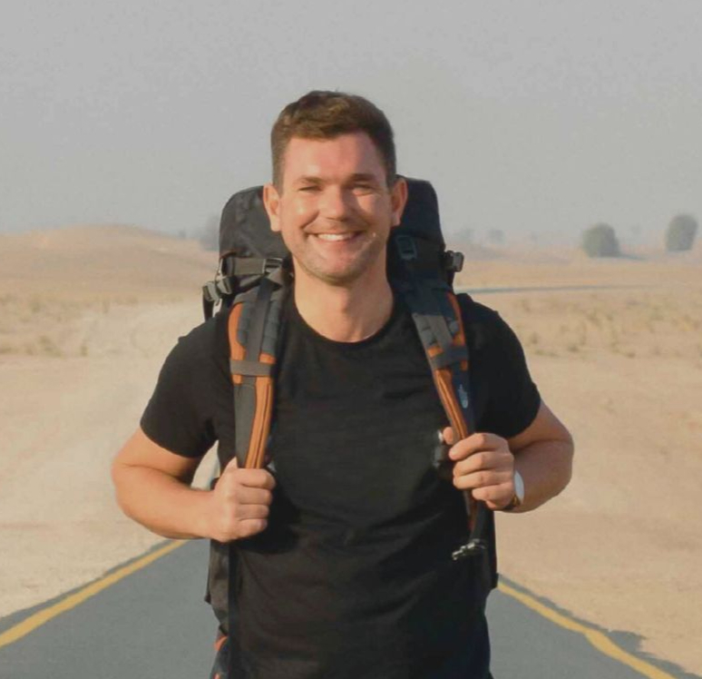

A practical guide to hiking Ben Nevis — from travelling by train from Glasgow and following the trail to the summit, to what to pack and everything I've learned from climbing Britain's highest mountain.
Having recently moved to Scotland after more than a decade living in Dubai, I was thinking about what to do for my 40th birthday.
It had been a turbulent start to life back in the UK. I'd moved to Scotland for a new role, only to be made redundant not long afterwards. Suddenly, I had some big decisions to make about what came next — and I felt like I needed a day in the wilderness to clear my head.
Then it dawned on me: hiking Ben Nevis would be a pretty good way to welcome both a new decade and a new chapter of my life.
It's one of those adventures that fits perfectly into a day, but provides enough of a challenge to leave you with a real sense of achievement when you finally reach the summit and return back down.
Being based in Edinburgh, I decided to document my journey from Glasgow Queen Street, taking the spectacular West Highland Line north to Fort William — a journey made by thousands of walkers and adventure seekers every year.
That first climb was back in 2022. Since then, I've returned to the summit of Ben Nevis twice more, experiencing the mountain in very different weather conditions, with varying numbers of people on the trail and, importantly, picking up a much better understanding of what climbing Britain's highest mountain is actually like.
So in this guide, I'll take you through getting to Ben Nevis by public transport, the route I use to reach the summit, what to expect on the mountain, what I've learned from my three climbs and whether I think it's an adventure worth making the journey for.
At A Glance
Location: Ben Nevis
Height: 4,413 feet
Route featured in this guide: Ben Nevis Tourist Path
Starting point: Glen Nevis Visitor Centre
Distance: Approx 10.5 miles there and back
Elevation gain:
Typical hiking time: 8-10 hours depending on pace
Difficulty: Moderate to Difficult
Nearest town: Fort William
Best time to hike: Summer months but weather can be unpredictable on the mountain
Public transport possible?: Yes to Fort William, taxi needed to trail start point.
Watch my complete Ben Nevis hiking experience
Getting to Ben Nevis from Glasgow by train
Beginning my journey at Glasgow Queen Street, you already get the sense that adventure isn't far away. It's a city-centre station, yet look around and you're likely to see more backpacks, hiking gear and outdoor clothing than suits and briefcases.
From here, the West Highland Line takes you north to Fort William, with the journey taking around three-and-a-half hours.
The train itself is fairly basic, and I wouldn't rely on having much in the way of food and drink available onboard. I'd recommend picking up some snacks and drinks before leaving Glasgow, then settling in for what is a spectacular journey north.
And perhaps the simplicity of the train only makes what's happening outside the window feel even more impressive.
First comes Loch Lomond, before the railway begins to leave the more populated parts of Scotland behind and pushes deeper into the Highlands. Mountains rise around you, secluded lochs appear beside the tracks and eventually you find yourself crossing the vast wilderness of Rannoch Moor.
The West Highland Line is regularly described as one of the world's great scenic railway journeys and, having travelled it to Fort William, it's not difficult to understand why.

There is one practical thing you need to be aware of. At Crianlarich, the train divides, with one section continuing towards Oban and the other heading north towards Fort William. Make sure you're sitting in the correct part of the train, although announcements and staff onboard should help keep you right.
There's also a brief pause at Crianlarich while the train is divided, which on my journey gave me a chance to step onto the platform before continuing north.
By this stage, the remoteness, mountains and moorland have already created a real sense of adventure. In many ways, travelling to Ben Nevis by train sets up what's to come beautifully.
Then, not long before arriving in Fort William, comes the moment you've been waiting for.
On a clear day, you can catch your first glimpses of Ben Nevis from the train, perhaps even its summit. After spending hours travelling through the Highlands, Britain's highest mountain suddenly appears ahead of you, almost asking:
Are you ready?
Well, yes.
But a hike to the summit is better suited to an early morning start, so for now I'm checking into a hotel and leaving my proper introduction to Ben Nevis until tomorrow.
Once you arrive in Fort William, there's also a Morrisons supermarket beside the railway station, which is extremely handy for stocking up before your hike. Water, sports drinks, sandwiches, fruit and plenty of snacks can all be picked up here before heading to your accommodation.
I'd always rather carry slightly more food and water than I eventually need on a mountain day than find myself running short halfway up.
Where does the Ben Nevis hike start?

The Ben Nevis Visitor Centre in Glen Nevis is where you'll find the start of the Mountain Track, the most popular walking route to the summit of Ben Nevis. It is also referred to as the Pony Track or Tourist Path.
If you're staying in Fort William without a car, one of the simplest options is to take a taxi from your hotel or the town centre to the Visitor Centre. It's only a short journey, and means you can save your legs for the rather more substantial walk ahead.
So, with my bag packed, a short taxi ride behind me and a willingness to conquer the UK's highest mountain, I'm ready to go.
Inside the Visitor Centre you'll find toilets, a small shop and somewhere to pick up drinks before setting off. If you're driving, there's also a paid car park beside the Visitor Centre.
One thing that has always amused me about the parking machine is having to choose how long you're planning to stay.
Two hours? Four hours?
I'm not entirely sure who's climbing Ben Nevis and returning within either of those, so I've always gone for the reassuring all-day option.
From the Visitor Centre, you'll see a bridge crossing the River Nevis. Head across and you've officially begun your journey towards the highest point in the UK.
And on my first attempt, Ben Nevis didn't take long to introduce me to another important part of climbing mountains in Scotland.
Almost as soon as I crossed the bridge, it started raining.
Cue an immediate stop to pull on the waterproofs.
As I would discover over this climb and my subsequent visits, they're one piece of kit I'd never set off up Ben Nevis without.
My experience hiking Ben Nevis
The first part of the climb

After crossing the bridge and following the path to the right, you'll soon take a left, with signposts helping you along this first stretch. This is where the climbing begins as you make your way towards the Mountain Track.
Over to your left you'll see the Ben Nevis Inn, in a glorious setting beneath the mountain and perfectly positioned for a well-earned post-hike pint later on.
For now, though, resist the temptation.
After gradually climbing for a few minutes, you'll cross a stile and find another sign directing you towards the Mountain Track. Follow it, cross another stile and you'll soon begin climbing out of Glen Nevis.
On some of my climbs, this lower stretch has been shrouded in cloud with visibility reduced considerably. But that can produce its own reward: climb high enough and you can suddenly emerge above it, with incredible views along the glen and a blanket of white cloud sitting beneath you.
The path through this first section is generally easy to identify, initially following a well-maintained track before larger rocks begin to form natural steps as you climb.
It's a gradual but persistent ascent and, after a while, the path begins to switch back on itself as you gain height. Small waterfalls tumble down the mountainside and there's even a bench along this stretch which makes for a welcome rest stop.
On a clear day, it's also a perfect excuse to stop and appreciate just how quickly the Highland views are opening up behind you.
After crossing a small bridge, the path turns left and the climbing becomes steeper. Large rocks effectively form a staircase up the mountain and you'll start asking rather more of your legs.
The trick, I've found, is not to rush.
Ben Nevis isn't a sprint. Find a comfortable pace and concentrate on making consistent progress towards the summit.
And remember to occasionally turn around.
With every bit of height you gain, the view behind you becomes more impressive.
A sharp U-turn puts you back onto smoother terrain before another turn brings you towards one of the most recognisable landmarks on the route and some flatter ground providing a welcome break from the first couple of hours of climbing.
Ahead and to your left is Lochan Meall an t-Suidhe, often known as the Halfway Loch.
And over to your right, the next challenge is waiting.
The upper mountain.
Reaching the halfway point

Although I'll usually stop for snacks during the climb through the glen, the area around Lochan Meall an t-Suidhe is a good opportunity for a more substantial break.
You've already put a decent amount of climbing into your legs and, with the upper section of Ben Nevis still ahead, it's a sensible time to refuel.
Continue along the flatter path with the lochan to your left and the route will eventually turn right towards the mountain.
There are plenty of rocks around this section that provide natural places to sit, have some lunch and prepare yourself for the second half of the climb.
Continue a little further and you'll reach the Red Burn, where water flowing down from the upper mountain crosses the path.
It's a beautiful spot and there are rocks to help you across, although depending on how much water is flowing, don't be surprised if your boots get a little wet.
Then again, this is Ben Nevis.
There's a reasonable chance they're already wet.
The upper section of Ben Nevis

After crossing the Red Burn, continue along the path until you reach a sharp left-hand turn. There is beutiofully positioned rock here I always sit on for a few minutes and take ion the views towards For William, Loch Eil and Loch Linnie.
It's around here that I always feel the character of the mountain begins to change.
The vegetation disappears. The landscape becomes increasingly barren. Green gives way to rock and loose rubble, and ahead of you lies a long series of zig-zags climbing towards the summit plateau.
The weather can change dramatically here too.
I've experienced clear conditions lower down the mountain only to find myself enveloped by cloud and rain as I've climbed higher.
And on my first Ben Nevis ascent, this was also the point where I noticed something else.
I seemed to be the only person still going up.
I regularly passed walkers heading in the opposite direction who had summited earlier in the day, but I couldn't see anyone ahead of me climbing.
As I climbed higher, that feeling of isolation became very real.
If you're hiking Ben Nevis alone, it's important that somebody knows your route and expected timings, and that you're properly equipped for the conditions. On this climb I was carrying plenty of food and water, additional clothing, a torch and emergency equipment including a survival blanket.
I've also personally received a mobile signal during my hikes on the Mountain Track, but I would never rely on that being available. Coverage can vary by network, location and conditions.
The zig-zags themselves can feel never-ending.
On this first climb, I settled into a rhythm: walk for a while, stop briefly, catch my breath and continue. Every turn became another small milestone.
The visibility was poor, the rain was pouring and, as you'll see in the video above, conditions were becoming increasingly unpleasant.
Eventually I passed another group coming down.
"Almost there," they told me.
"How long?"
"About 20 minutes."
Excellent.
Nearly there.
Reaching the summit of Ben Nevis

Once the switchback section is over, you'll turn left and begin the final approach towards the summit plateau.
There are no signposts to speak of up here, but you'll see cairns marking the route across the upper mountain. In poor visibility especially, this isn't somewhere to start improvising your own shortcut.
On my first climb, I bump into another group of hikers here and once again ask how far I have to go.
"About 30 minutes."
What?!
Have I gone backwards? I thought I was within 20 minutes of the summit.
Then comes the slightly less reassuring piece of information. They believe they're the last people coming down, which means I'm now on my own approaching the highest point in the UK.
The concentration needed to navigate the route while also filming the video above is probably helping to keep my mind occupied, but I won't lie, it's a little spooky up here on my own in these wintry conditions.
This is early October and the sun had been shining at sea level.
Now, snow is falling and beginning to settle.
Everything becomes incredibly quiet.
For stretches, the only sounds are my boots crunching through loose gravel and newly fallen snow, and the metallic tap of my water bottle swinging against a carabiner attached to my rucksack.
I'm layered up and my body is warm from the climbing, but my fingers are providing a fairly useful reminder of just how cold it has become.
Keep the gloves on.
Am I nervous up here?
Yes.
But one slow step at a time, I continue.
The gradient begins to ease as you approach the summit plateau, but this isn't somewhere to become complacent. There are enormous drops around the upper mountain which can be extremely difficult to appreciate when visibility is poor.
If conditions are clear, you may even be able to see the summit structures ahead and feel tempted to simply walk directly towards them.
Don't.
Stick to the established route rather than attempting to cut across unfamiliar ground. In poor visibility especially, proper navigation and preparation become even more important.
Eventually, though, I reach the summit plateau.
The first thing to emerge through the cloud is the ruins of the old Ben Nevis Observatory.
It's quite remarkable to think that this was once a working meteorological station, continuously operating from 1883 until 1904 and recording hourly weather observations in some of the most extreme conditions in Britain.
Even more remarkably, there was once a hotel up here too.
The Observatory Hotel opened in 1885, offering meals and four bedrooms to visitors who had made the climb to the summit during the summer months.
Imagine checking into a hotel at the top of Ben Nevis after the climb I've just had.
Sadly, there's no hotel stay for me tonight.
The buildings are now roofless ruins and, as I take the final few steps towards the summit, I spot the emergency shelter nearby.

With the weather closing in, it briefly crosses my mind that I may need to hunker down in there for the night. It's around 3pm, and part of me wonders whether staying somewhere dry might actually be safer.
My mind then very quickly shuts down the thought of spending the night in there alone.
I have my final few lines to record at the summit.
I get my camera ready and film the ending sequence of the video above.
Once I switch off from work mode, however, I'm faced with the cold reality that I now have to get back down this mountain.
Alone.
And at that exact moment, I see a man approaching through the gloom.
The relief is palpable.
I'm not alone after all.
He reaches the summit, we say hello and start chatting. He tells me he'd taken the Caledonian Sleeper overnight from London to Fort William before beginning his Ben Nevis climb that morning.
Immediately, my next Ben Nevis adventure begins forming in my head.
We help each other get the obligatory summit photos and, given the conditions and the time of day, decide it would be sensible to descend the mountain together.
That chance meeting would eventually bring me back to Ben Nevis for a second adventure, this time taking the Caledonian Sleeper from London to Fort William and heading straight from the train towards Britain's highest mountain.
Read my experience taking the Caledonian Sleeper from London to hike Ben Nevis (Coming Soon)
For now, though, there is still one rather important part of this adventure left.
Getting back down.
The hike back down
Reaching the summit of Ben Nevis, the highest mountain in the UK, is of course an achievement.
You'd be forgiven for standing proudly at the top and thinking you've completed the challenge.
But don't be fooled.
You still have to get back down.
And in some ways, I've found the descent almost harder.
It's more punishing on your knees and joints, your footing requires plenty of concentration and, by the time you finally reach the bottom, you'll be more than ready to collapse into the Ben Nevis Inn for a well-earned drink.
Loose rock and gravel can make sections of the descent particularly slippery, especially when your natural momentum encourages you to move considerably faster than you did on the way up.
This is not somewhere I'd like to get injured, so steady as she goes is very much the name of the game.
The long switchback section once again feels like it will never end, except this time your footing becomes even more important. On loose sections, I find it useful to gently test the surface beneath my boot before committing my full weight to the next step.
One thing that does distract you from your increasingly tired legs is the view.
In good visibility, descending Ben Nevis gives you a completely different perspective on the landscape you've spent the previous few hours climbing through.
You're no longer staring upwards towards the next section of mountain.
Instead, the Highlands are laid out in front of you.
It's spectacular.
Although it's still worth spending rather more time watching where you're putting your feet.
Eventually, the switchbacks are behind you and suddenly it feels like you're making real progress.
You cross the Red Burn again and return to that short stretch of flatter ground beside Lochan Meall an t-Suidhe.
The first proper flat ground since you walked along this exact section on the way up.
It feels like days ago.
Then comes the rocky staircase.
Those large rocks and boulders that required plenty of effort to climb earlier now present a different challenge.
Your body's natural momentum wants to carry you downhill much faster than is sensible, so take your time and pick your steps carefully.
The Ben Nevis Inn isn't going anywhere.
Eventually, you're back into the glen and onto the final stretch.
You're steadily losing altitude now, heading back towards Glen Nevis with the bottom of the Mountain Track finally beginning to feel within reach.
It's around here that my knees and legs really begin to complain.
Going up, it felt like my lungs were doing most of the work.
Coming down, my joints have decided it's their turn.
But one step at a time, with the occasional stop to give my legs a rest, I keep descending.
And eventually, after hours on the mountain, I reach the bottom.
Then, almost magically, there it is.
The Ben Nevis Inn

My new hiking companion and I stumble inside, almost with the unsteady legs you'd ordinarily associate with people leaving a pub rather than entering one.
Ben Nevis has turned our legs to jelly.
We order a pint, congratulate each other and collapse onto a sofa.
Perfect.
Apart from one small detail.
The sofa is upstairs.
Those final few steps feel like Ben Nevis adding insult to injury.
By this point, though, I don't really care.
I'm back down safely. I've stood on the highest point in the UK. I've experienced sunshine, rain, cloud and snow. I've somehow found a hiking companion at precisely the moment I needed one.
And there's a pint in my hand.
What an adventure.
How long does it take to climb Ben Nevis?
Climbing Ben Nevis is definitely a full day's adventure.
For me, it took around five hours to reach the summit and another four hours to get back down, although your timings will depend on your fitness, mountain experience, how often you stop and, importantly, the weather.
Official guidance suggests allowing roughly 6–9 hours to complete the Mountain Track, with the Ben Nevis Visitor Centre giving an average of around 7–8 hours.
Personally, I wouldn't plan the day too tightly around those numbers.
I'd set aside a good 10–12 hours so there is absolutely no need to rush. If the weather plays nicely, you'll want time to stop along the way, enjoy the views and spend a little while at the summit rather than immediately turning around.
An early start is also well worth it.
Apart from giving you plenty of daylight and some breathing room if the hike takes longer than expected, I always find it much more enjoyable being amongst the people heading up a mountain rather than starting your climb as streams of hikers are already coming back down.
How difficult is Ben Nevis?

The standard Mountain Track up Ben Nevis isn't a technically difficult hiking route in normal summer conditions. There is no scrambling required and, for much of the climb, there is a well-established path leading you towards the summit.
That doesn't make it easy.
Ben Nevis rises to 1,345 metres and the Mountain Track is around 16km (10 miles) there and back.
Mountaineering Scotland describes it as a demanding walk, and having now climbed it myself multiple times, that feels about right.
The ascent is essentially a long, sustained slog uphill.
There are sections of loose rock, large stone steps and increasingly rough terrain as you climb higher.
My approach was simply to go slowly and steadily, taking regular breaks rather than trying to race up the mountain.
Higher up, the weather can introduce another challenge. When cloud comes in, visibility can deteriorate remarkably quickly and the route becomes much less obvious.
Snow can make it harder still. The Visitor Centre specifically warns that the ability to navigate with a map and compass is essential in poor visibility.
And don't underestimate the journey back down.
Nine hours on the mountain meant my legs were fairly pleased to see Fort William again.
The descent is relentless in a different way and the rocky terrain can be particularly tiring on your knees.
So I wouldn't describe Ben Nevis as technically difficult via the Mountain Track in good conditions.
I would describe it as a long and physically demanding mountain day that deserves respect.
Do you need to be fit to climb Ben Nevis?
You don't need to be an elite athlete to climb Ben Nevis, but you do need a decent level of fitness and enough stamina to keep walking uphill for several hours before turning around and doing the entire journey in reverse.
I've seen people of all shapes, ages and fitness levels on Ben Nevis, so I don't think there is a useful single definition of who can and can't do it.
Only you really know your own ability.
If you've never done a mountain hike before, though, I'd personally build up to Ben Nevis with some lower hills first. That's also the advice from Mountaineering Scotland, which recommends trying some smaller Scottish hills if you don't already have experience of this kind of walking.
It will give you a much better idea of how your body copes with a sustained climb, rough terrain and, importantly, the long descent afterwards.
What should you pack for Ben Nevis?
What you need will vary depending on the season and conditions, but this isn't a walk I'd begin with just a bottle of water and whatever happens to be in my pockets.
From my own experience, and taking into account the official advice for the Mountain Track, I'd make sure I had:
Proper hiking footwear with good grip and support
Waterproof jacket and trousers
Warm layers, plus hat and gloves even when conditions lower down seem mild
Spare/dry clothing
Plenty of food and snacks
At least two litres of water per person
Map and compass, and the knowledge to use them
Fully charged mobile phone
Portable phone charger/power bank
Head torch, even if you're expecting to finish in daylight
Small first-aid kit
Emergency shelter or bivvy bag
Sun cream and sunglasses when conditions warrant them
That might look excessive when you're standing in Fort William beneath blue skies.
Several hours later, 1,345 metres higher and surrounded by cloud, it may look rather more sensible.
Mountaineering Scotland recommends warm, windproof and waterproof clothing, suitable footwear, spare layers and emergency equipment. It also recommends carrying a map and compass or GPS and knowing how to navigate, while the Visitor Centre warns that mobile reception can be patchy. I have had a good signal every time I have climbed the mountain, but that will depend on your network and no doubt, weather conditions?
Winter is a completely different proposition. Snow and ice can require specialist equipment such as crampons, an ice axe and appropriate winter boots, together with the skills to use them.
That's well beyond the scope of this guide and certainly not something I'd treat as simply a colder version of the summer hike.
What is the best time of year to climb Ben Nevis?
For most recreational hikers following the Mountain Track, the warmer months offer longer daylight hours and the best chance of more favourable conditions.
But Ben Nevis doesn't appear to pay much attention to what season your calendar says it is.
I've climbed here in October with sunshine lower down and something resembling a blizzard near the summit. I've also experienced beautiful clear conditions in September.
Even during summer, Mountaineering Scotland warns that the summit and upper slopes can be cold, wet and windy, with snow potentially remaining high on the mountain.
So rather than choosing a date months in advance and assuming the weather will cooperate, I'd keep an eye on the mountain forecast as the day approaches and be prepared to change your plans.
If you're relatively inexperienced, I'd personally choose a summer attempt with plenty of daylight and aim for a day with a favourable mountain forecast.
The mountain will still be there tomorrow.
Ben Nevis weather and safety

I'm not a mountain guide, so I'm not going to pretend this article can tell you whether conditions are safe for your particular climb.
What I can tell you from my own experiences on Ben Nevis is just how dramatically conditions can change between Fort William and the summit.
You can begin the day looking up at blue sky and several hours later find yourself walking through cloud, rain, strong wind or even snow.
That's part of what makes Ben Nevis such an adventure.
It's also why it needs to be taken seriously.
Check the mountain weather, not just Fort William
This is probably the biggest weather lesson I've learned from hiking Ben Nevis.
Don't simply check the forecast for Fort William.
The summit is 1,345 metres above sea level and conditions up there can be completely different to those in town.
Mountaineering Scotland specifically warns against assuming the weather at the summit will resemble conditions in Fort William or even at the car park.
Before setting off, I would check a dedicated mountain forecast. The Ben Nevis Visitor Centre uses forecasts from the Met Office and Mountain Weather Information Service and can also provide information about current conditions.
And remember that a forecast is still a forecast.
Conditions can change quickly.
Can you climb Ben Nevis in bad weather?
Experienced mountaineers with the right equipment and navigation skills may be comfortable in conditions that would make turning around the sensible decision for somebody with less experience.
The important thing is being prepared to change the plan.
Cloud can reduce visibility to just a few metres and the path can become difficult to follow, particularly higher up.
There is also serious steep cliff drops around the summit plateau, which makes correct navigation particularly important when visibility is poor.
I've turned around on mountains before when conditions haven't felt right and I've never regretted it.
Reaching the summit is a wonderful feeling.
Getting safely back down matters considerably more.
Is Ben Nevis worth climbing? Final thoughts

It absolutely is.
Ben Nevis isn't the most technical mountain I've climbed and, on a clear day, it might not even be the most dramatic.
But there is something special about standing on the highest point in the UK after getting yourself there under your own steam.
And for me, the experience is about much more than those few minutes at 1,345 metres.
It's the journey into the Highlands. Arriving in Fort William with Ben Nevis looming somewhere above you. The excitement of setting off in the morning. Those first kilometres when you quickly realise quite how long a day you've signed up for. The conversations with other hikers. The landscape slowly changing as you climb. And then, quite often, watching the weather completely transform as you approach the summit.
I've climbed Ben Nevis more than once now and it has never given me exactly the same experience.
That's part of the appeal.
You might get those enormous views across the Highlands that you see in photographs. You might reach the summit and find yourself standing inside a cloud. You might even start in sunshine and find yourself walking through snow a few hours later.
But whatever Ben Nevis gives you, reaching the summit feels earned.
And then, of course, you have to walk all the way back down.
By the time I reached the bottom on this trip, I'd spent around nine hours on the mountain.
My legs were tired, my feet had certainly had enough and there was only one place I wanted to go.
The Ben Nevis Inn.
Sitting inside with a cold pint, looking back towards the mountain I'd just spent the day climbing, was probably one of my favourite moments of the entire trip.
Because that's what I love about adventures like this.
The summit is the target, but it's everything around it that turns the climb into a story.
So if you're reasonably fit, properly prepared and pick the right conditions for your experience level, I'd absolutely put Ben Nevis on your list.
Give yourself the whole day. Don't rush it. Respect the mountain. And remember to occasionally stop, turn around and look at where you've come from.
The view is usually worth it.
I'll continue sharing sports travel guides, ticket tips and experiences from stadiums, arenas and sporting destinations around the world here on Sports Travel Tom.
You can also follow the journey on Instagram, YouTube and TikTok @sportstraveltom, where I share regular ticket updates, travel guides and sporting adventures to help you travel better for sport and adventure.


Comments